Freshwater Bodies
Freshwater bodies
New Zealand’s fresh water bodies include glaciers, snow, rivers, streams, lakes, wetlands, springs and aquifers and groundwater.
Rivers
A ‘river’ is defined in the RMA as ‘a continually or intermittently flowing body of fresh water; and includes a stream and modified watercourse; but does not include any artificial watercourse (including an irrigation canal, water supply race, canal for the supply of water for electricity power generation or farm drainage canal)’.
72fa9282-66dd-4b78-9ddb-129fbb47ac97
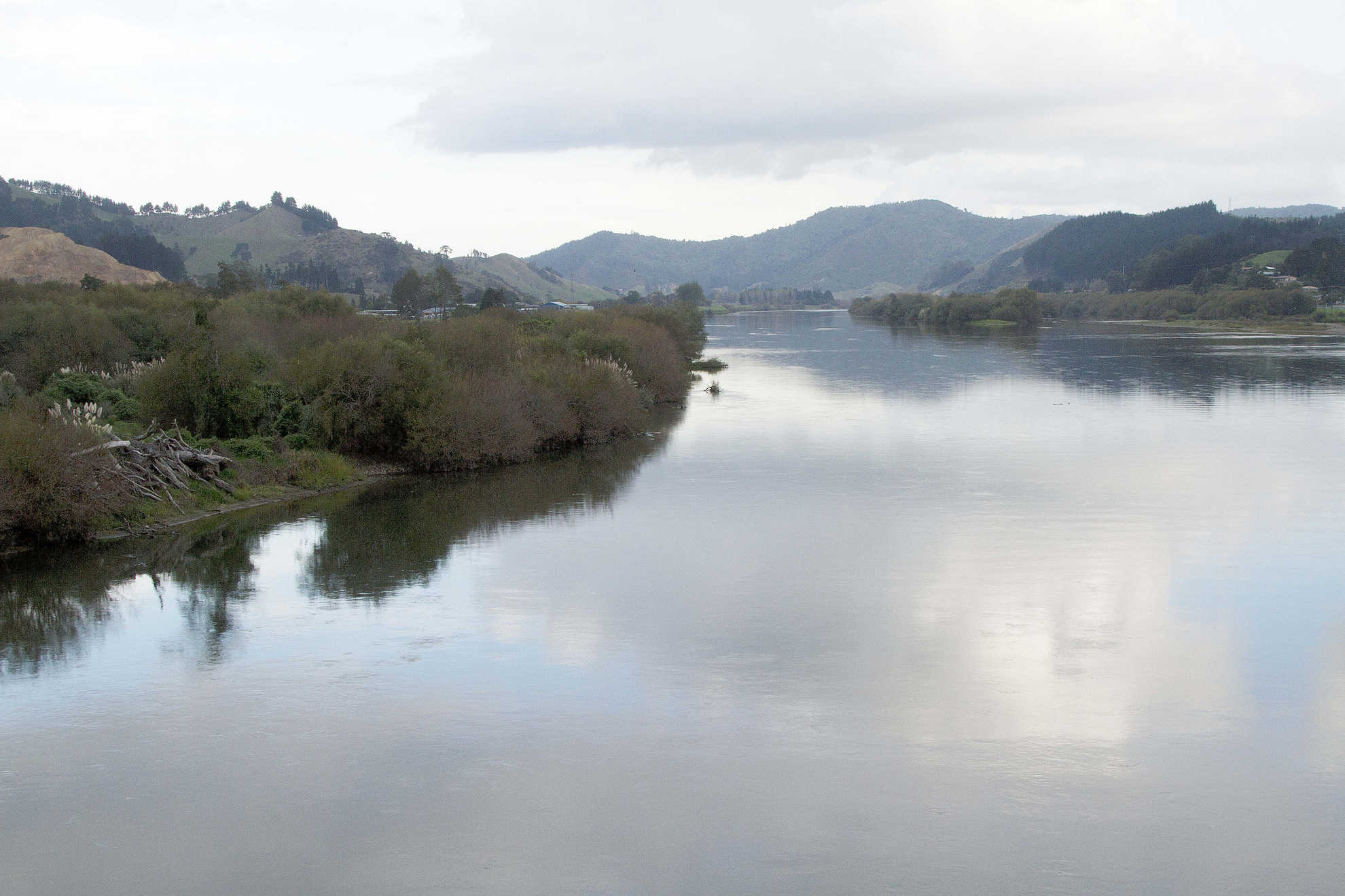
New Zealand has 70 major river catchments, 40 in the South Island and 30 in the North Island, and over 425,000 kilometres of rivers and streams
3dcdfdc7-3563-4239-abc7-73b9f65dcffe
.
It is difficult to state with great accuracy the number and extent of smaller streams in New Zealand. Although some streams are permanent fixtures, others are intermittent (only flowing at certain times of the year) or ephemeral (only flowing for short periods of time following particular rain events) and their large number makes counting them an extremely challenging task.
Because of New Zealand’s geography (being a narrow country with ridges of high mountains running along the centre and extensive hill country) and its high rainfall, rivers and streams are often relatively short, fast flowing and unstable. The large variety of rock types in New Zealand catchments means that there are many different types of rivers and they vary significantly.
A River Environment Classification system has been developed for New Zealand rivers. It is GIS-based and classifies rivers at a range of spatial scales on the basis of six hierarchical levels. Four are related to the catchment (climate, source of freshwater flow, geology and land cover) and two are focused on specific sections of the river (position of the section of the river within the catchment network and the landform of the valley in which the river section is located). The classification system has been applied to all rivers in New Zealand and is useful in informing the selection of appropriate management tools to manage pressures on particular types of rivers. c88c7760-0a48-4145-8d60-3b8dc7e7ab3a
North Island Rivers
In Northland and on the Coromandel Peninsula rivers tend to be short, and in some cases, as sea levels rose after the last ice age, their lower reaches have become flooded and now form arms of the sea. The Hokianga Harbour is an example of this phenomenon. In the Waikato, the main rivers are alluvial and flow through floodplains that have been created by deposited sediment. New Zealand’s longest river is located here, the Waikato River which flows for 425 kilometres, from the slopes of Mount Ruapehu north-west to the Tasman Sea at Port Waikato. The Tongariro power development has added a significant extra catchment to the Waikato River, incorporating the headwaters of the Whanganui and Rangitikei Rivers.
In the western uplands of the North Island, rivers such as the Whanganui and the Mokau incise deeply and often flow through long gorges. On the central volcanic plateau and in the Bay of Plenty, recent volcanic activity has shaped the course and character of the rivers, with the Tarawera and Kaituna Rivers draining lakes that formed in volcanic craters.
South Island Rivers
South Island rivers are equally diverse. There are significant differences between the rivers east and west of the main divide. West of the Southern Alps, there are rivers that have headwaters in very steep mountains. These rivers tend to flow quickly and feature rapids and scenic gorges. The Buller, Motueka and Grey rivers are good examples of this type of river. In contrast, Canterbury features slower flowing braided rivers. In Southland the rivers are alluvial which means they are fed by rain. In Otago, rivers such as the Clutha and Taieri have their origins in the Southern Alps and flow through basins in schist blocks. Snowmelt is a significant factor in the seasonal variation of flow of the mountain-sourced rivers.
Meandering Rivers
Meandering rivers are common throughout New Zealand. They typically contain only one channel. The rivers are relatively slow flowing, and have pronounced bends, which are called meanders. The meanders are formed when moving water erodes material from the outside of a bend, and deposits it on the inside, creating a snaking pattern as the river flows downstream.
Braided Rivers
Marlborough and Canterbury are well known for their braided rivers, which are glacial in origin. A braided river is one that, over some part of its length, flows in multiple channels across an alluvial-gravel fan. These fans can be very wide, potentially stretching over areas several kilometres wide. Braided rivers have been classified as naturally uncommon ecosystems 62f92973-6800-426f-adf6-7bf056f6ec21 that have an endangered threat status 27bee10d-6d84-4151-bf09-ab8dba64a1fd due to significant degradation and ecosystem modification over the last 50 years.
Braided rivers often occur in areas where there are steep mountain ranges that have the capacity to create their own weather, like the Southern Alps or the mountains of the central North Island. Similar conditions give rise to braided rivers in Canada, Alaska, and the Himalayas. The height of the mountains causes precipitation to fall on them at any time of the year, leading to high levels of erosion, and the creation of floodplains. The erosion is exacerbated by the steepness of the mountains and in some cases glacial activity. Eroded material runs downstream, and yields the gravel that lines the channels, shaping the river into interlinked braids of varying sizes.
Although there are many braided rivers in New Zealand (163 of New Zealand’s river systems, located in 11 of New Zealand’s regions, feature braided sections) the majority of significant braided rivers are found on the eastern side of the South Island, like the Waimakariri River in Canterbury bd339e0d-84a5-4e87-b9c3-2e34c2146dc2 .
Braided rivers amount to much more than just the braids that can be seen from above: the gravel riverbed can be several metres deep. Surface water continually moves down through the gravel, connecting and mixing with the groundwater below, such as occurs along the lower Selwyn River in Canterbury. The level of the groundwater rises as a result of the inputs from the river and then may appear across the flood plain as small springs. The channels have a tendency to move around, because of the variability of the flow of water and supply of sediment to the river system. Together the river, floodplain and groundwater make up a complex three dimensional ecosystem, which is constantly changing.
Lakes
A ‘lake’ is defined in the RMA as ‘a body of fresh water which is entirely or nearly surrounded by land’.
c50a1772-bf27-449a-b294-d03f212f8278
Lakes cover about 1.3 per cent of New Zealand’s land area (excluding offshore islands). New Zealand has 3,820 lakes which are larger than one hectare and 775 which have a margin at least 0.5 kilometre long. About 40 per cent of New Zealand’s lakes are in catchments where the predominant land cover is pasture and less than 2 per cent of them are in towns and cities. Lake margins are considered "vulnerable" ecosystems. cb08da94-453f-422e-b8ce-6e7bf262c954
The diverse landscapes of New Zealand have resulted in the formation of a number of different types of lake. c564a814-5dc6-42fc-86ca-f4d729865b69 The largest lake in New Zealand is Lake Taupo, located in the central North Island, which covers 616 square kilometers. It was formed by the inundation of a massive volcanic caldera 26,500 years ago. The eight next largest are glacial lakes located in the South Island high country including Lake Te Anau which is 348 square kilometers in size. Lake types include glacial lakes (e.g. Wakatipu), volcanic lakes (e.g. Taupo), landslide lakes (e,g, Waikaremoana), dune lakes (e.g. Kai Iwi), and human-made lakes (e.g. Benmore).
Glacial lakes
Glacial lakes such as Manapouri, Wakatipu, and Wanaka were created during the glacial periods of the last two million years. As glaciers grew, they eroded large steep-sided valleys, and carried with them piles of rock and soil that acted as natural dams once the glacier retreated. The eroded basins then filled with water. The deepest of these lakes, and the deepest in New Zealand, is Lake Hauroko in Western Southland which reaches a depth of 462 metres, well below sea level.
Volcanic lakes
New Zealand has a number of volcanic lakes, which are mainly found in the Taupo volcanic zone and the area around Auckland. Lakes Taupo and Rotorua fill calderas, which are enormous volcanic depressions caused by the land collapsing after a huge eruption of ash. Other volcanic lakes were created when explosive eruptions formed craters, or when the drainage of rivers was blocked by lava flows and ash deposits.
Lakes are relatively common in volcanic areas, because when the drainage pattern is disrupted by volcanic activity, water will tend to accumulate in the low areas. Many have no surface outlet, draining underground. Some have quite variable levels. Some volcanic lakes receive an input of hydrothermal or volcanic fluids and are therefore high in minerals and other chemical substances which yield unusual colours and making them potentially unsafe to swim in.
The Rotorua area has an extensive network of 20 volcanic lakes including Lakes Rotorua, Rotoiti, Rotoehu, Rotoma, Ōkataina, Ōkareka, Rotokakahi, (Green Lake), Tarawera, Rotomahana, Tikitapu (Blue Lake) and Rerewhakaaitu.
Landslide lakes
Landslides can form lakes when they dam a river, causing water to build up behind the debris. For example, Lake Waikaremoana, in Te Urewera National Park (located between the Bay of Plenty and Hawke’s Bay) was created by a huge landslide that occurred roughly 2,200 years ago.
Dune lakes
Dune lakes, such as the Kai Iwi lakes in Northland, are typically found on the west coast of the North Island. They are mostly shallow lakes fed predominantly by rain water or groundwater, with their water level fluctuating with rainfall. Dune lakes form in stable sand dunes, where depressions in the sand are below the watertable, and rainwater or groundwater accumulates in the depressions. Many of these lakes have been severely impacted by excess nutrients and invasive species. For example, Lakes Kapoai, Rotokawau and Waiporohita in Northland are hypertrophic, meaning they are saturated with nutrients and have frequent algal blooms.
Human-made lakes
There are more than 60 human-made lakes in New Zealand, created for power generation, irrigation, water supply and recreation. Narrow valleys are frequently dammed to create reservoirs that hold water for domestic and industrial use, such as those in the Waitakere and Hunua ranges which supply water to Auckland. Very large artificial lakes are created to generate hydroelectric power, such as Lake Benmore on the Waitaki River, which has an area of 74 square kilometres.
The amount of water flowing out of the lake is controlled and the power of the falling water is used to turn turbines which generate electricity. The water levels of some naturally occurring lakes are artificially controlled for irrigation and to reserve flow for electricity generation. Lake Hood in Ashburton was created to provide recreational opportunities for the community.
Lake water levels
Although lake water usually appears to be fairly static, complex changes happen constantly which are very important for the health of the freshwater body. The level of the lake reflects the relative amounts of water entering and leaving: some water is constantly lost through evaporation, seepage and possibly outflow into rivers, while it is being replenished by groundwater, rainfall, rivers or glaciers.
Lakes with no outflow into a river or stream will usually vary in level depending on the amount of inflow from sources such as groundwater or rainfall. Lakes with an outflow will maintain a relatively stable water level because the amount of water leaving the lake will simply increase when inflow increases. Rivers transport sediment into lakes making them shallower over time. Eventually lakes can be totally filled in by this process. Lakes are therefore usually relatively young in geological terms, being mostly under 10,000 years old.
Wetlands
Wetlands are defined in the RMA as including ‘permanently or intermittently wet areas, shallow water, and land water margins that support a natural ecosystem of plants and animals that are adapted to wet conditions’.
98b72a83-7088-4cc7-a8eb-5ea2150a918a
The National Policy Statement for Freshwater Management 2020 limits the application of its policies about wetlands to those wetlands that meet the following definitions:
- A natural wetland means a wetland as defined above, that is not:
- A wetland constructed by artificial means (unless it was constructed to offset impacts on, or restore, an existing former natural wetland);
- A geothermal wetland; or
- Any area of improved pasture that at the commencement date, is dominated by (that is more than 50% of) exotic pasture species and is subject to temporary rain-derived water pooling.
- A natural inland wetland means a natural wetland (as defined above) that is not in the coastal marine area.
The same definitions apply to activities controlled in the National Environment Standards for Freshwater.
Wetland composition varies widely because of regional and local differences in soils, topography, climate, hydrology, water chemistry, vegetation and other factors, including human disturbance. Wetlands have three things in common. The first of these is, unsurprisingly, water. Secondly, they all have wetland soils, which have low levels of oxygen or none at all, because they are intermittently or permanently saturated. Low levels of oxygen are also due, in part, to bacterial breakdown of high levels of organic matter. The soil is often fine textured, deep enough to store water, and has poor downward drainage. Thirdly, wetlands all support wetland plants, which have adapted to growing in wet conditions.
Wetlands of different types can be found all over the country – along hillsides where there is a change in slope or geology, on stream and river floodplains, in low-lying areas among flat landscapes, in coastal areas where sand dunes trap water runoff, and along the margins of rivers, lakes and estuaries. Their varying characteristics give rise to many combinations of features.
Wetlands can be supplied by water from a number of different sources – including rain, groundwater, and surface runoff. Some wetlands occur at the edges of rivers, lakes or coastal areas. Many wetlands were once rivers that have partly drained away. Some wetlands, particularly in the central North Island, are geothermal in origin
There are nine classes of wetland in New Zealand: bog, fen, swamp, marsh, seepage, shallow water, ephemeral, pakahi gumland, and saltmarsh. 9bf3d74e-ba9f-432e-8a3b-b81c9ed253fc
Wetlands are often highly productive systems because they contain plenty of nutrients as well as water. The nutrients are derived from the decay of plant material as well as from sediment washed in from flooding rivers. However, some wetlands have low nutrient levels and are relatively unproductive. For example bogs that are fed only by rainfall have simpler plant communities, and slower decay of plant material, which accumulates as peat.
Wetlands were a primary food source for traditional Māori society:
“The importance of lowland swamps in the traditional Māori landscape was multifaceted. They watered and gave access to vast areas of country, birds were attracted to them for food and native fish that came to spawn. Dominating the swamps were rushes, flax and kahikatea or white pine. Mature, fruiting kahikatea were are seasonal mecca for birds and people. Waikaka (mudfish), a traditional delicacy for presentation at feasts, hibernated during summer drought beneath kahikatea roots. They and myriad indigenous fish species such as inanga, koaro and kokopu migrated through the estuaries and lagoons into pools enclosed by flax and raupo in the gaps in the kahikatea forests. It was these conditions that made tidal swamp-plain rivers like the Waihou, Waikato and Manawatu such superb fisheries. It was these same estuaries and lagoons that would later be taken by the Crown for drainage scheme spillways.” (Park, G, 2001)
Many of New Zealand’s wetlands have been drained in order to expand pastureland or urban areas. Others have been damaged through the impacts of stock grazing and other human activities. Less than 10 per cent of New Zealand’s pre-human settlement wetlands remain. This is a very small amount compared to the 40 per cent thought to remain in the more densely populated Netherlands and United Kingdom and the 90 per cent which remain in France.
ed08001d-0698-4346-8680-6756687f25e2
Many of the remaining wetlands have been degraded by weed invasion, stock access, modifications and barriers to fish migration. The ongoing grazing and drainage of wetlands for urban and rural development is further reducing this scarce habitat type and introduced species continue to invade these areas.
New Zealand is a party to the Ramsar Convention on Wetlands which aims to improve the conservation of wetlands around the world. New Zealand has designated six wetlands of international importance under the convention which are:
c8c2c2e2-e8ee-4dfb-8235-75e0e5f9354c
- Awarua Wetlands/Waituna Lagoon, Southland
- Farewell Spit, Nelson
- Whangamarino, Waikato
- Kopuatai Peat Dome, Waikato
- Firth of Thames, Waikato
- Manawatu River Estuary, Foxton
The Ramsar Convention also requires the wise use of all wetlands. "Wise use” of wetlands is “the maintenance of their ecological character, achieved through the implementation of ecosystem approaches, within the context of sustainable development" where "ecological character” is “the combination of the ecosystem components, processes and benefits/services that characterise the wetland at a given point in time.” f1393651-ce0e-48c8-92d9-5d073a63fb34
Groundwater
Groundwater is rainwater that has travelled through the soil, or from river and lake beds, to aquifers. Aquifers are underground rock formations that are sufficiently permeable so as to contain or conduct significant amounts of water. Groundwater makes up a large proportion of New Zealand’s freshwater resource, totalling around 612 billion cubic metres.
adab63b4-465a-46cd-8b90-fe23e4f9fcf2
There is groundwater almost everywhere in New Zealand. In some areas, people rely on groundwater as their main water resource, such as the residents of Christchurch City and half of the rural population of the Waikato region. Groundwater is pumped to the surface for human use through wells or bores. Sometimes the water from aquifers is mineralised and requires treatment before it can be used for people, stock, irrigation or industry.
Although one might assume that groundwaters are stationary bodies of water, they are actually part of flowing water systems that often incorporate surface water as well. But very little is often understood about the way that groundwater moves and how it interfaces with water on the surface. This can make effective management difficult.
Aquifer types
Groundwater aquifers can be split into two types – confined and unconfined 2bfc308b-5f1b-447b-a6c3-77a528b67a3b .In confined aquifers, the water rises up inside the aquifer under natural pressure, because it is confined between impermeable sediments above and below the water. In unconfined aquifers, the water is not under such pressure, and flows through sediments, often interacting with surface water in rivers, lakes and wetlands or eventually discharging to the coast.
The most extensive aquifers are shallow, unconfined, sand and gravel sediments. In particular, they are found in areas such as the shallow, porous gravels that occupy old river plains like the Heretaunga Plains in Hawkes Bay and the Wairarapa and Southland Plains. These aquifers contain relatively young, well oxygenated and fast flowing groundwater. The mineral content in these aquifers is generally low, but the shallow water table makes them vulnerable to pollutants, such as nutrients and bacteria from land use. Other productive forms of aquifer include the fractured basalts of the Auckland region and the Coromandel’s coastal sand aquifers.
It can take a very long time for the water in aquifers to be exchanged. Some underground water is very old, with the oldest thought to be in the Moutere gravel aquifer near Nelson, where the water has been underground for more than 20,000 years b625f802-980d-4b81-8eff-49c36bb809e5 . In other areas the residence time can be much shorter. A study of aquifers in the Rotorua area identified a mean residence time of underground water of between 14 and 170 years. 6a179aae-9650-4e10-8b6e-af1012dbb497 This long residence time means that there is usually a significant delay between pollution of groundwater occurring, and it being detected, often only when the contaminated water flows to the surface. As a result, nutrients levels in streams fed by aquifers in agricultural areas are likely to continue to increase as the clean ‘older’ aquifer water is progressively replaced by newer, contaminated water.
Christchurch City’s water supply
One of the most significant aquifers for water supply is the Christchurch-West Melton aquifer. This provides all of the city of Christchurch’s water supply, and has been estimated to have an economic value of $60 million per year. Water is pumped up from the aquifer from more than 50 sites around the city. At each site there are one or more wells drilled to depths of between 22 and 190 metres. The aquifer is recharged by rainfall and the Waimakariri River. b8bf197d-495b-4b8f-bee6-b90a12a9bd16
Geothermal
‘Geothermal water’ is defined in the RMA as being ‘water heated within the earth by natural phenomena to a temperature of 30 degrees Celsius or more’.
354faf98-fb66-4d17-b365-d992a00291b5
Geothermal groundwater is heated, either by the energy of nearby volcanic activity, or because it has been located very deep underground where the earth’s temperature is hotter. Sometimes this water can reach the surface through cracks in rock. Waiwera and Parakai in the Auckland region, Hot Water Beach on the Coromandel Peninsula and Hanmer Springs in the South Island are good examples of such geothermal springs
Geothermal groundwater has a very high mineral and salt content, as these chemicals dissolve in the hot water as it moves up from deep underground, often making it unsuitable for drinking. However, geothermal water and steam is prized as a tourist attraction and for use in geothermal power generation. The extraction of geothermal water in New Zealand is strictly regulated, as over-extraction is likely to allow cooler water to mix with the aquifer, reducing the heat and damaging the resource.
Geothermal power generation currently supplies around 13 per cent of New Zealand’s electricity, with stations mainly located within the Taupo volcanic zone. 71a3d296-6ae9-410a-b735-35bc6670b424
-
Section 2 Resource Management Act 1991
-
Snelder T, B Biggs and M Weatherhead, 2004; http://www.mfe.govt.nz/environmental-reporting/about/tools-guidelines/classifications/freshwater/index.html
-
Section 2 Resource Management Act 1991
-
Nathan S, ‘Lakes - New Zealand lakes’, Te Ara - the Encyclopedia of New Zealand, www.TeAra.govt.nz/en/lakes/1
-
Park G, 2006, Theatre Country: Essays on landscape and whenua, Victoria University Press, Wellington 180
-
http://www.doc.govt.nz/about-doc/role/international/ramsar-convention-on-wetlands/wetlands-in-nz/nz-wetlands-of-international-importance/
-
http://www.ew.govt.nz/environmental-information/Groundwater/; Scarsbrook M and C Pearson, ‘Water Resources – Groundwater and Lakes’, Te Ara – Encyclopedia of New Zealand, http://www.teara.govt.nz/en/water-resources/4
-
Morgenstern U et al, 2004, , in J Harding, P Mosley, C Pearson and B Sorrell (eds), Freshwaters of New Zealand, New Zealand Hydrological Society Inc and New Zealand Limnological Society Inc, iii
-
Section 2 Resource Management Act 1991
-
http://www.ccc.govt.nz/Water/HowWeGetOurWater/
-
Ramsar Secretariat Ramsar Resolution IX.1 (2005), Annex A.
-
http://www.doc.govt.nz/about-us/statutory-and-advisory-bodies/nz-conservation-authority/publications/protecting-new-zealands-rivers/02-state-of-our-rivers/overview-of-new-zealand-rivers/
-
https://www.landcareresearch.co.nz/publications/factsheets/rare-ecosystems/inland-and-alpine/braided-riverbeds
-
Holdaway et al. (2010) http://onlinelibrary.wiley.com/doi/10.1111/j.1523-1739.2012.01868.x/full
-
http://www.doc.govt.nz/Documents/about-doc/concessions-and-permits/conservation-revealed/braided-rivers-canterbury-lowres.pdf
-
Holdaway et al. (2012) http://onlinelibrary.wiley.com/doi/10.1111/j.1523-1739.2012.01868.x/full
-
Johnson and Gerbeaux (2004) http://www.doc.govt.nz/documents/science-and-technical/WetlandsBW.pdf
-
http://www.arc.govt.nz/environment/water/water-monitoring/groundwater.cfm
-
http://icm.landcareresearch.co.nz/research/land/Moutereaquifer.asp
-
Section 2 Resource Management Act 1991.
Last updated at 3:35PM on August 23, 2021