Legislation
There are a number of pieces of legislation in New Zealand that are designed to protect biodiversity. The following table summarises the legislation.
Legislation | Adminstered By | Key Elements |
|---|---|---|
| Conservation Act 1987 | Department of Conservation |
|
| National Parks Act 1980 | Department of Conservation |
|
| Reserves Act 1977 | Department of Conservation |
|
| Crown Pastoral Land Act 1998 (at time of writing, the Crown Pastoral Land Reform Bill is progressing through Parliament) | Land Information New Zealand |
|
| Queen Elizabeth the Second National Trust Act 1977 | Queen Elizabeth the Second National Trust |
|
| Forests Act 1949 | Ministry for Primary Industries |
|
| Overseas Investment Act 2005 | Overseas Investment Office |
|
| Resource Management Act 1991 (including national direction) | Local government |
|
| Local Government Act 2002 | Local government |
|
| Wildlife Act 1953 | Department of Conservation |
|
| Trade in Endangered Species Act 1989 | Department of Conservation |
|
| Native Plants Protection Act 1934 | Department of Conservation |
|
| Wild Animal Control Act |
| |
| Te Urewera Act 2014 | Te Urewera Act Board |
|
| Te Awa Tupua (Whanganui River Claims Settlement) Act 2017 |
|
Conservation Act
The purpose of the Conservation Act, as expressed in its long title, is ‘to promote the conservation of New Zealand’s natural and historic resources, and for that purpose to establish a Department of Conservation’. As well as establishing the Department of Conservation, the legislation provides for the creation of conservation areas. These are areas of Crown-owned land which are declared to be held for ‘conservation purposes’ (section 7).
The Conservation Act and all other Acts listed in Schedule 1 of the Conservation Act must be interpreted and administered to give effect to the principles of the Treaty of Waitangi. The Supreme Court’s decision in Ngāi Tai ki Tāmaki Tribal Trust v Minister of Conservation [2018] NZSC 122 concerned the Department of Conservation (DOC)’s consideration of Treaty principles in the granting of two commercial tour concessions on Rangitoto and Motutapu Islands. The judgment clarified that DOC is required in some circumstances to consider the possibility of according a degree of preference to iwi as well as the potential associated economic benefit of doing so. It also confirms that s 4 of the Conservation Act does not create a power of veto for an iwi or hapū over the granting of concessions, nor any exclusive right to concessions in their rohe. The Ngāi Tai ki Tāmaki judgment has broader implications beyond the two concession decisions at issue in the case; it is relevant to DOC’s statutory decisionmaking function, to statutory management planning, and to the operational delivery of conservation outcomes at place. The judgment also emphasises the fundamental importance of Treaty of Waitangi principles in the statutory scheme of the Conservation Act 1987. From DOC’s perspective, the judgment highlights a need to consider more actively the role that partnerships with iwi/Māori can occupy in the delivery of conservation outcomes.
Conservation areas
Stewardship areas are conservation areas that do not have any other classification. Sometimes referred to as a “holding pen”, stewardship areas can nonetheless have high ecological value. There are longstanding calls for stewardship areas to be assessed and formerly classified where they deserve a higher level of protection, or disposed of if they do not hold conservation value. 237f84e7-73d1-4a19-b7d8-768278e43f62
Conservation areas may be given specific protection requirements through their designation as a conservation park, wilderness area, ecological area, sanctuary area, amenity area, or wildlife management area. Land which is adjacent to a waterbody, which is subject to a water conservation order or which has outstanding wild, scenic, or other natural or recreational characteristics, can be held for the purpose of a watercourse area. The management requirements attached to each of these designations, along with stewardship areas and marginal strips, is shown in the table below.
Protection Status | Management Requirements |
|---|---|
| Conservation Park |
|
| Wilderness Area |
|
| Ecological Area |
|
| Sanctuary Area |
|
| Amenity Area |
|
| Wildlife management area |
|
| Watercourse Area |
|
| Stewardship area |
|
| Marginal strip |
|
The Conservation Act sets out how conservation areas are to be managed. This must be in accordance with statements of general policy, conservation management strategies, conservation management plans and freshwater fisheries management plans prepared under the same legislation (section 17A). In addition, an area which has a specific designation, as described above, must be managed in accordance with that designation. Every conservation area will be subject to a conservation management strategy and may have a conservation management plan in place. You can view conservation management plans and conservation management strategies on the DOC website. Conservation management strategies must be reviewed every 10 years, but in practice many have not been reviewed within that period.
Disposal and Exchange
Conservation areas may not be disposed of, other than in accordance with the Conservation Act (subject to the Public Works Act 1981 and State-Owned Enterprises Act 1986).
Stewardship areas may be exchanged if the Minister is satisfied, after consultation with the local Conservation Board, that the exchange will enhance the conservation values of land managed by the Department and promote the purposes of this Act.
These provisions, the nature of stewardship areas, and conservation policies relating to disposal and exchange, were considered in Hawkeʼs Bay Regional Investment Company Ltd v Royal Forest and Bird Protection Society of New Zealand Inc [2017] NZSC 106.
Concessions
The Minister of Conservation can grant concessions for activities undertaken in conservation areas under the Conservation Act. All commercial activities except mining require a concession to cross or operate within conservation land (for mining, see Minerals.
Any person may apply for such a concession. Applications for concessions lasting more than ten years must be publicly notified (and other concessions may be publicly notified), and in those circumstances members of the public can make submissions on them. The Minister is required to consider a range of factors when deciding whether or not to grant the concession (section 17U) which include:
- The effects (positive and adverse) of the activity, structure or facility
- Any measures that can reasonably and practicably be undertaken to avoid, remedy, or mitigate any adverse effects of the activity
- Any relevant environmental impact assessment, including any audit or review
- Any relevant oral or written submissions received
The Minister must not grant a concession that is contrary to the provisions of the Act or the purposes for which the land is held, or where the activity could reasonably occur outside conservation land or in a less impactful part of a conservation area, or where the concession is not consistent with a conservation management strategy or plan for the area (section 17W).
Marginal strips
Marginal strips are established under the Conservation Act (section 24) to protect areas adjacent to water bodies and to enable appropriate public access to these areas. These are usually 20 metre-wide riparian areas which extend along and abut the landward margin of the foreshore, the normal level of the bed of any lake not subject to control by artificial means, or the bed of any river or any stream which has an average width of three metres or more. Marginal strips must be reserved from the sale or other disposition of Crown land. “Sale or other disposition” includes a land exchange (Hawkeʼs Bay Regional Investment Company Ltd v Royal Forest and Bird Protection Society of New Zealand Inc [2017] NZSC 106.)
Freshwater Fisheries Regulations 1983 and Conservation (Indigenous Freshwater Fish) Amendment Act 2019
These regulations under the Conservation Act control a wide range of matters relating to freshwater fish. Notable are regulations that prohibit creation of fish passage barriers without authorisation from the Director-General, and that allow the creation of faunistic reserves (which prohibit all fishing within them). The regulations and the Act (section 26ZM) also control all movement of aquatic life between waterbodies and electric fishing. The regulations set out when fish can be taken (full protection is only provided to one extinct fish species).
The Conservation (Indigenous Freshwater Fish) Amendment Act 2019 improved protection for freshwater fish through tools for better management of their main threats, such as barriers to fish passage, loss of spawning sites and noxious fish such as koi carp. It also enabled better management of activities such as drain clearing, and provided for the Director-General of Conservation to introduce authorisation for whitebaiting in conservation areas if necessary to better manage whitebaiting. The Amendment Act included minor changes to the Freshwater Fisheries Regulations 1983.
National Parks Act 1980
The purpose of the National Parks Act is ‘preserving in perpetuity as national parks, for their intrinsic worth and for the benefit, use, and enjoyment of the public, areas of New Zealand that contain scenery of such distinctive quality, ecological systems, or natural features so beautiful, unique, or scientifically important that their preservation is in the national interest’ (section 4(1)).
New Zealand currently has 13 national parks throughout the country, following the dis-establishment of Te Urewera National Park in 2014 (which is now run under a special agreement between the Crown and Tuhoe iwi - see Te Urewera Act 2014). These national parks include some of New Zealand’s most iconic protected areas. The Act sets out principles to be applied to the management of national parks in section 4, and these include achieving the purpose as set out above, preserving the parks ‘as far as possible in their natural state’, and exterminating introduced plants and animals as far as possible. Subject to the management principles, the public are to ‘have freedom of entry and access to the parks, so that they may receive in full measure the inspiration, enjoyment, recreation, and other benefits that may be derived from mountains, forests, sounds, seacoasts, lakes, rivers, and other natural features’ (section 4(2)(e)).
As well as providing an invaluable resource for biodiversity protection, national parks underpin New Zealand’s international tourism industry.
In some places, this is placing pressure on national parks and having detrimental impacts. In 2021, the Parliamentary Commissioner for the Environment produced a report calling for changes to tourism management to ensure tourism does not have unsustainable impacts on New Zealand’s most valued places. b546ef44-f7a3-4d0c-a3f2-8636b37f07b0
The impacts of pests and weeds along with other wild animals, such as tahr, are also a significant driver of biodiversity loss in national parks. The Department of Conservation’s tahr control plans, and the relationship between the National Parks Act and the Wild Animal Control Act, were considered in New Zealand Tahr Foundation Inc v Minister of Conservation [2020] NZHC 1669.

Reserves Act
Protected areas called ‘reserves’ can be established under the Reserves Act. Reserve land is categorised on the basis of its primary purpose as either recreation, historic, scenic, nature, scientific, government purpose or local purpose reserves. Each reserve which is vested in, or controlled and managed by, an administering body such as a local authority or iwi trust is required to have a reserve management plan and to be managed in accordance with the purpose for which it is classified.
Type of Reserve | Primary Purpose |
|---|---|
| Recreation |
|
| Historic |
|
| Scenic |
|
| Nature |
|
| Scientific |
|
| Government Purpose |
|
| Local Purpose |
|
Conservation covenants
The Reserves Act also provides for the creation of conservation covenants. A covenant is a legal agreement between a landholder and a covenanting agency and this can set out how an area’s natural values will be protected. This is a legal contract between a landowner and a third party that outlines the way the land will be managed. Entry into such agreements is usually voluntary, but the agreement can be binding in perpetuity if it is included on the property title. Land covenants have grown in popularity in recent years and highlight a very real commitment by many landowners to protect indigenous biodiversity on their land.
The Minister of Conservation, any local authority, or any other approved body, may enter into a covenant with a landowner to provide for the management of that land in a manner that will preserve the natural environment, landscape amenity, wildlife, freshwater life, marine life or historical value. A conservation covenant may be in perpetuity or for a specific term (section 77 of the Reserves Act). Once a conservation covenant is in place the ‘offences’ contained in the Reserves Act apply to the land as if it was a reserve (section 77 of the Reserves Act).
Crown Pastoral Land Act 1998
There are three main types of land tenure in the high country that are relevant to biodiversity management, being:
- Public conservation land – land owned by the Crown, and managed and administered by the Department of Conservation on behalf of the public.
- Private land – private rural land is normally held in freehold title. Freeholding removes the need for Crown consent for a range of land management activities
- Crown leasehold land – the Crown purchased much of the South Island high country from Ngāi Tahu during the 1840s and 1850s. a37c6e91-2830-4e7f-b496-4b14999874fc Under the Land Act 1948, the Crown retained ownership of the land, with farmers being granted 33-year perpetually renewable pastoral leases. There are also Pastoral Occupation Licences and Special Leases with no right of renewal and the legislative provisions are subtly different for each of these.
The concept behind the Crown leasehold approach is that the lessee (farmer) has long-term certainty of tenure, but that the government can place conditions on the use of these fragile lands. In January 2018, there are approximately 1.4 million hectares of high country in pastoral leasehold tenure. Lessees also require the Crown Commissioner’s consent to undertake a range of activities on the land including burning any part of the land, planting any trees or felling any bush or scrub.
During the 1990s, a process commenced to review some of the high country leases. This resulted in farmers obtaining freehold title over part of the land (potentially subject to protective mechanisms such as covenants), with the remainder being incorporated into the conservation estate and managed by the Department of Conservation (potentially subject to ongoing farming access such as grazing licences). The process was formalised under the Crown Pastoral Land Act.
To date, one of the main outcomes of the tenure review process has been that the relatively productive lower altitude terraces, fans and basins have been placed in freehold ownership, while the colder, steeper, higher altitude tussock grasslands have become public conservation land. 781fa6bf-d4db-4a84-8330-7161325581f4 This means that tenure review achieves additional protection for relatively well-protected ecosystem types but enables intensification and land use change on relatively poorly protected ecosystem types.
In 2019, the Government undertook consultation on reforming Crown pastoral land management. d3dbd3ca-0210-4758-990a-44d203172afb This resulted in the Crown Pastoral Land Reform Bill 2019, which passed its first reading on 23 July 2020 and is currently before Select Committee. The Bill if passed will end tenure review for all leases except those where a substantive proposal has already been put to a leaseholder, and will reform management of crown pastoral land by LINZ and the Commissioner of Crown Lands.
Queen Elizabeth the Second National Trust Act 1977
The Queen Elizabeth the Second National Trust Act 1977 has the general function ‘to encourage and promote, for the benefit and enjoyment of the present and future generations of the people of New Zealand, the provision, protection, preservation, and enhancement of open space’ (section 20(1)). The Act also establishes a National Trust Fund which serves as a recipient of funding from the government and other sources including private donations.
Open space covenants
The main mechanism available to the QEII Trust to achieve its functions is the establishment of open space covenants over private land. A covenant is a legal agreement between a landholder and a covenanting agency and this can set out how an area’s natural values will be protected. This is a legal contract between a landowner and a third party that outlines the way the land will be managed. Entry into such agreements is usually voluntary, but the agreement can be binding in perpetuity if it is included on the property title. Land covenants have grown in popularity in recent years and highlight a very real commitment by many landowners to protect indigenous biodiversity on their land.
Open space covenants are designed to preserve any landscape of aesthetic, cultural, recreational, scenic, scientific, or social interest or value. These have the effect of constraining the uses which may be made of the land which is subject to the covenant, normally excluding activities such as vegetation clearance, subdivision and development. The covenants are registered on the title and bind future land owners in perpetuity. The QEII Trust monitors adherence to the conditions of the covenants.
More than 3400 landowners are protecting over 110,000 hectares of natural and cultural heritage with QEII Trust covenants. The QEII Trust also owns 29 properties, which collectively protect 1,686 hectares of significant habitat. The properties have mostly been gifted. In addition to the legal covenant, the QEII Trust offers assistance with fencing costs, survey costs and practical advice.
Local authorities often provide rates relief in order to encourage property owners to protect and preserve open spaces for the benefit and enjoyment of present and future generations. The Local Government (Rating) Act 2002 provides that certain land is non-rateable, including QEII Trust land and land which is owned by a society or association, which is used for conservation purposes and not for private profit, and which is able to be accessed by the general public (section 8). However, targeted rates for water supply, sewage disposal, or refuse collection are payable (section 9). Open space covenants are subject to the Public Works Act 1981, meaning that protection in perpetuity can be lost if the land is required for a public work.
For more information go to the QEII Trust website.
Forests Act 1949
Logging of indigenous forest on private land for timber production is controlled by the Forests Act 1949. A major amendment to this legislation in 1993 provided a regime to manage the sustainable logging of privately-owned forests. Timber may not be felled except in accordance with a sustainable forest management plan or permit, which is approved by the Minister for Primary Industries. The export of the timber is also unlawful unless it was taken in accordance with a registered sustainable forest management plan or permit (section 67C) and Schedule 2 of the Forests Act sets out the requirements for sustainable logging practices.
Overseas Investment Act 2005
The Overseas Investment Act requires consent to be gained for a transaction that will result in the acquisition of sensitive land by an overseas person (section 12). The Act lists a number of factors which should be considered when assessing the benefit to New Zealand of an overseas investment in sensitive land. These include whether the overseas investment will benefit New Zealand, and whether there are or will be adequate mechanisms in place for protecting or enhancing existing areas of:
- Significant indigenous vegetation
- Significant habitats of indigenous fauna
- Significant habitats of trout, salmon, wildlife protected under the Wildlife Act and game as defined in the Wildlife Act
- Walking access to those habitats by the public or any section of the public (section 17)
See Coromandel Watchdog of Hauraki (Inc) v Minister of Finance [2020] NZHC 2345 for an unsuccessful challenge to a decision granting approval under the Act for the acquisition by Oceana Gold of rural land for a tailings dam. Coromandel Watchdog argued that in assessing “benefit to New Zealand” the relevant ministers must have regard to detrimental environmental effects.
Wildlife Act
The Wildlife Act, administered by the Department of Conservation, protects all ‘wildlife’ in New Zealand apart from the species identified in schedules 1 to 6 of the Act as shown below. This means that the default position is that wildlife cannot be hunted unless specifically provided for in the schedules.
Wildlife
The term ‘wildlife’ is defined to mean ‘any animal that is living in a wild state’, with some specific exceptions. The definition of ‘animal’, however, does not include all New Zealand’s fauna. It includes:
- All mammals, excluding domestic animals, rabbits, hares and marine mammals
- All birds, excluding domestic birds
- All reptiles
- All amphibians
- Invertebrates and marine species that are declared to be wildlife
Schedule | Species |
|---|---|
| Schedule 1 – Wildlife declared to be game | Includes the black swan, four species of duck, partridge, pheasant, pukeko and three species of quail (although not those on the Chatham Islands) |
| Schedule 2 – Partially protected wildlife | Includes the brown skua, little owl and silvereye, Landowners are permitted to hunt these if they are causing damage. |
| Schedule 3 – Wildlife that may be hunted or killed subject to Minister’s notification | Includes a range of species on the Chatham Islands as well as three species of shag, sooty shearwater and weka. These may only be hunted if the Minister has given participation through formal notification. |
| Schedule 5 - Wildlife not protected | Includes a range of introduced species including cats, dogs, cattle, horses, mustelids and introduced birds, three species of dog, a skink and turtle |
| Schedule 6 – Animals declared to be noxious animals | Includes 10 species of deer, possum, wallaby, goat, pig and Himalayan Tahr |
Additional invertebrates have also been included under the protection of the legislation and these are listed in schedule 7. They include specific species of snails, spiders, beetles, weevils, grasshoppers and weta. Schedule 7A sets out marine species which are protected and these include black, gorgonian, and stony corals, as well as hydrozoa (hydra-like animals). Five species of shark are protected (the oceanic whitetip shark, basking shark, deepwater nurse shark, white pointer shark and whale shark). Two rays are protected (manta ray and spinetail devil ray). Somewhat surprisingly, only two species of bony fish are protected; the giant grouper and spotted black grouper.
Offences
It is an offence to hunt or kill protected wildlife. However, protected species may be captured, injured or killed inadvertently or as part of a fishing operation and the legislation provides a defence against prosecution when this happens, so long as the incident is reported to the relevant authority.
Wildlife Sanctuaries
The Wildlife Act makes provision for the establishment of wildlife sanctuaries (where all wildlife is absolutely protected unless there is any provision to the contrary in a Proclamation), wildlife refuges and wildlife management reserves which may be proclaimed by the Governor-General and have rules restricting activities attached.
Population Management Plans
The Act also makes provision for the development of population management plans where fishing activity inadvertently results in the death of protected species. This is primarily targeted at the protection of seabirds which can become entangled in fishing gear such as hooks, lines and nets. The plans are designed to identify the maximum allowable level of fishing-related mortality for the species, which would allow the following two criteria to be met:
- For threatened species, the mortality level ‘should allow the species to achieve non-threatened status as soon as reasonably practicable, and in any event within a period not exceeding 20 years’.
- For other marine wildlife, the mortality level ‘should neither cause a net reduction in the size of the population nor seriously threaten the reproductive capacity of the species’.
No population management plans have yet been approved under these provisions.
In Shark Experience Ltd v PauaMAC5 Inc [2019] NZSC 111, the Supreme Court considered the application of the Wildlife Act to shark cage diving. The Court’s decision included consideration of the meaning of the offence term “hunt or kill”, holding that a broad definition not requiring intention to kill or injure wildlife applied, but set aside the Court of Appeal’s declaration that shark cage diving is an offence under the Act.
Trade in Endangered Species Act 1989
This legislation implements New Zealand’s obligations under CITES. It has the object to enable New Zealand to fulfill its obligation under CITES and to promote ‘the management, conservation, and protection of endangered, threatened and exploited species to further enhance the survival of those species’ (section 2). The Act is administered by the Director-General of Conservation.
It establishes a permitting system for trade in species included in the Schedules in the Act, which identify species endangered, threatened and exploited by trade and reflect those listed in CITES.
Native Plants Protection Act 1934
This old and little used piece of legislation is still law and allows the Governor-General to declare that native plant species are to be protected. It is an offence for any person to take any protected native plant ‘growing on any Crown land, or in any State forest land or public reserve, or on any road or street’. In addition, any person who ‘without the consent of the owner or occupier of any private land, takes any protected native plant that is growing thereon’, commits an offence. The penalties provided in the legislation are so low – a maximum of $10 for a first offence, $20 for a second offence and $40 for subsequent offences – that it provides no real deterrent.
Wild Animal Control Act 1977
The Wild Animal Control Act (“WAC Act”) provides for control of wild animals, by giving the Minister of Conservation obligations to prepare and carry out wild animal surveys, assessments of hunting and hunter influences, and any other matters concerning the incidence of wild animals and the means of controlling them, conduct wild animal research work, co-ordinate the policies and activities of other Government entities and private land owners in relation to the control, and (where necessary) eradication, of any species of wild animals. The Minister may prepare wild animal control plans and statements of general policy, which must not derogate from the WAC Act or any other enactment, or any conservation management strategy. The Minister must administer and manage wild animals in accordance with plans and policy statements under the WAC Act, and with conservation management strategies under the Conservation Act.
The WAC Act requirements, and the relationship between the WAC Act and conservation legislation, were considered in in New Zealand Tahr Foundation Inc v Minister of Conservation [2020] NZHC 1669.
Te Urewera Act 2014
The purpose of the Te Urewera Act 2014 is to establish and preserve in perpetuity a legal identity and protected status for Te Urewera for its intrinsic worth, its distinctive natural and cultural values, the integrity of those values, and for its national importance, and in particular to:
- strengthen and maintain the connection between the iwi of Tūhoe and Te Urewera;
- preserve as far as possible the natural features and beauty of Te Urewera, the integrity of its indigenous ecological systems and biodiversity, and its historical and cultural heritage
- provide for Te Urewera as a place for public use and enjoyment, for recreation, learning, and spiritual reflection, and as an inspiration for all
The Act removes Te Urewera from the National Parks Act 1980 and instead establishes a Board to act on behalf of, and in the name of, Te Urewera and to provide governance for Te Urewera. The Board is required to prepare a Te Urewera management plan and generally perform functions similar to those undertaken by the Department of Conservation for conservation areas. In performing its functions, the Board may consider and give expression to Tūhoetanga, Tūhoe concepts of management such as rāhui, tapu me noa, mana me mauri and tohu.
Activities such as taking plants, killing animals, or making roads require authorisation by an activity permit issued by the Board. The Board also has the functions of a Minister with respect to access arrangements for mining. Te Urewera is treated as “Schedule 4” land meaning mining generally cannot be authorised.
It is possible that Te Urewera Act may be seen as a blueprint for future conservation land tenure and management.
Te Awa Tupua (Whanganui River Claims Settlement) Act 2017
The Act specifies that Te Awa Tupua (Whanganui River) is an indivisible and living whole, comprising the Whanganui River from the mountains to the sea, incorporating all its physical and metaphysical elements. Tupua te Kawa comprises the intrinsic values that represent the essence of Te Awa Tupua, namely—
- Ko te Awa te mātāpuna o te ora: the River is the source of spiritual and physical sustenance: Te Awa Tupua is a spiritual and physical entity that supports and sustains both the life and natural resources within the Whanganui River and the health and well-being of the iwi, hapū, and other communities of the River.
- E rere kau mai i te Awa nui mai i te Kahui Maunga ki Tangaroa: the great River flows from the mountains to the sea: Te Awa Tupua is an indivisible and living whole from the mountains to the sea, incorporating the Whanganui River and all of its physical and metaphysical elements.
- Ko au te Awa, ko te Awa ko au: I am the River and the River is me: The iwi and hapū of the Whanganui River have an inalienable connection with, and responsibility to, Te Awa Tupua and its health and well-being.
- Ngā manga iti, ngā manga nui e honohono kau ana, ka tupu hei Awa Tupua: the small and large streams that flow into one another form one River: Te Awa Tupua is a singular entity comprised of many elements and communities, working collaboratively for the common purpose of the health and well-being of Te Awa Tupua.
The Act declares Te Awa Tupua to be a legal person. Persons exercising or performing a function, power, or duty under a range of specified Acts must recognise and provide for the Te Awa Tupua status; and Tupua te Kawa.
Te Pou Tupua is established to be the human face of Te Awa Tupua and act in its name. Its functions include acting and speaking for Te Awa Tupua, and Tupua te Kawa, promoting their health and well-being, acting as an affected person in RMA processes, and participating in a collaborative group to review and manage activities on the surface of the Whanganui River.
Biosecurity Act 1993
The Biosecurity Act authorises regional councils to monitor pests and pest agents and prepare and implement pest management plans for the control or eradication of pests. It is critical to New Zealand’s response to pest animals and weeds, which are a significant driver of biodiversity loss.
Under the Biosecurity Act, “pest” means “an organism specified as a pest in a pest management plan”. The definition is broad and largely self-fulfilling: if an animal is said to be a pest, it is a pest. A pest agent, in relation to any pest, means “any organism capable of helping the pest replicate, spread, or survive; or interfering with the management of the pest”.
Part 5 of the Act (pest management) provides for the eradication or effective management of harmful organisms that are present in New Zealand by providing for the development of instruments and measures to prevent, reduce, or eliminate the adverse effects of harmful organisms on a range of social, economic, environmental and cultural values, while appropriately distributing the costs of the instruments and measures. Regional pest management plans (RPMP) are one such instrument.
Resource Management Act 1991
The management of many of the effects of human activities on biodiversity in New Zealand is undertaken within the framework of the RMA. Biological diversity is defined in section 2 of the Act to mean ‘the variability among living organisms, and the ecological complexes of which they are a part, including diversity within species, between species, and of ecosystems’. The overarching purpose of the RMA is the sustainable management of natural and physical resources. It establishes a framework for the integrated management of air, land, freshwater and marine areas. This framework is described in detail elsewhere on this website.
Purpose, Principles and Functions
Purpose of the RMA
Section 5 of the RMA establishes the purpose of the Act, which is ‘to promote the sustainable management of natural and physical resources’. This is further defined to include:
(a) Sustaining the potential of natural and physical resources (excluding minerals) to meet the reasonably foreseeable needs of future generations; and
(b) Safeguarding the life-supporting capacity of air, water, soil and ecosystems; and
(c) Avoiding, remedying or mitigating any adverse effects on the environment.
The term “biodiversity” is not directly used, however, it is indirectly managed through all matters of Section 5(2). All forms of plants and animals (whether native to New Zealand or introduced) fall within the RMA’s definition of natural and physical resources. Therefore, natural and physical resources need to be managed while sustaining the potential of all forms of plants and animals to meet the reasonably foreseeable needs of future generations. Natural and physical resources also need to be managed while safeguarding the life-supporting capacity of air, water, soil and ecosystems.
Matter of national importance
Section 6 of the RMA identifies matters of national importance which decision-makers are required to recognise and provide for. Two section 6 matters have particular relevance to the management of biodiversity:
Section 6(a): The preservation of the natural character of the coastal environment (including the coastal marine area), wetlands, and lakes and rivers and their margins, and the protection of them from inappropriate subdivision, use and development.
Section 6(c): The protection of areas of significant indigenous vegetation and significant habitats of indigenous fauna.
The term “biodiversity” is not included in this list of matters, although it is indirectly managed by protecting natural character, outstanding natural features and landscapes, and the protection of indigenous vegetation and habitats of indigenous fauna. The term outstanding natural features and landscapes is not defined by the RMA.
Other matters
The RMA identifies a set of ‘other matters’ in section 7 to which decision-makers are required to ‘have particular regard’. Many section 7 matters have particular relevance to the management of biodiversity including kaitiakitanga (section 7(a)) and the intrinsic values of ecosystems (section 7(d)).
Council functions
Regional and district councils have explicit functions related to indigenous biodiversity. Regional Council are required to establish, implement, and review objective, policies, and methods for maintaining indigenous biodiversity (section 30(1)(ga)) and district councils are required to control actual or potential effects of the use, development, or protection of land for the purpose of the maintenance of indigenous biodiversity (section 31(1)(b)(iii)).
National Policy Statements and the New Zealand Coastal Policy Statement
National policy statements enable central government to prescribe objectives and policies on resource management matters of national significance, relevant to achieving the purpose of the RMA. The New Zealand Coastal Policy Statement’s purpose is to state objectives and policies in order to achieve the purpose of this Act in relation to the coastal environment of New Zealand. National policy statements are important tools to provide a higher level of government direction and consistency in the plan making process. It is mandatory that regional policy statements, regional plans and district plans give effect to national policy statements (sections 62(3), 67(3) and 75(3)). Consent authorities must also have regard to any relevant national policy statements when considering an application for a resource consent (section 104(1)(b)) or water conservation order (section 207(c)) and a requirement for a designation (section 171(1)(a)) or heritage order (section 191(1)(d)).
A National Policy Statement for Indigenous biodiversity is anticipated to be gazetted in 2021. This is likely to relate to terrestrial biodiversity only. Biodiversity in the marine environment is addressed by the NZCPS (see here), freshwater biodiversity is intended to be captured by the NPSFM and other nationally applicable protections (see here).
RMA policy statements and plans
Both regional and district councils have a statutory responsibility for maintaining indigenous biodiversity and both are subject to the requirement in section 6 of the RMA which requires them to recognise and provide for protection of significant areas of indigenous vegetation and significant habitats.
As a consequence, regional policy statements must specify the respective responsibilities of the regional and district council when it comes to maintaining indigenous biodiversity and including objectives, policies, and rules in their plans to achieve that outcome. c7991b7d-d9cd-44dc-8e12-a2e6ce0b72d0
When preparing policy statements and plans it is best practice for councils to consider the following matters:
- Actual outcomes of current policy and the gaps in policy when compared with the council’s aims
- Extent and condition of the indigenous biodiversity remaining within the region or district
- Actual and potential threats and other issues that affect that biodiversity
- Opportunities for preventing biodiversity loss and promoting its recovery where it has been damaged
- Likely future patterns in land use and other economic activity, and how these patterns and activity may affect biodiversity values within the life cycle of the policy
- Policies and other guidance about national priorities, including for ecosystems that are regionally/nationally rare
- Underlying level of community understanding and support for indigenous biodiversity
When implementing policy statements are plans and plans it is best practice for councils to consider the following matters:
- Developing plans in consultation with consents staff to help ensure the provisions can be effectively implemented
- Preparing a plan implementation strategy
- ‘Field-testing’ policies
- Developing guidelines and training for consents and enforcement staff
- Developing a formal checklist for planners to help them identify matters that need to be addressed for different types of applications and in different environments
- Developing consent condition templates designed to address different types of habitat and activity
- Forming or joining regional (and district) biodiversity forums to share information and ideas
Regional Policy Statements
Regional policy statements, which are prepared by regional councils under the RMA, are designed to provide an overview of resource management issues throughout the region and to identify policies and methods to achieve the integrated management of natural and physical resources (section 59). This enables a strategic and integrated approach to be applied to biodiversity management, which can be considered on a region-wide basis.
The following provides a checklist for possible contents of a regional policy statement related to biodiversity protection:
- Are all the key biodiversity issues and threats within the region and within the scope of regional policy statement included?
- Do the provisions give effect to all relevant national policy statements?
- Will the provisions achieve the maintenance of indigenous biodiversity generally?
- Have areas of indigenous vegetation and habitats that are regionally significant been identified (including those in the terrestrial, freshwater, coastal and marine habitats?)
- Have the main threats to the ecological health of these areas been identified?
- Do the provisions provide for the protection of significant indigenous biodiversity?
- Are there objectives related to all the key values, habitats and species?
- Is clear direction given for formulating regional and district plan objectives, policies and rules to protect biodiversity?
- Do the policies and methods provide for adequate management of the main threats to biodiversity?
- Are priority areas for restoration identified?
- Are the different roles of the regional council and the territorial authorities for biodiversity protection clearly defined?
- Is an integrated approach adopted which addresses terrestrial, freshwater, coastal and marine biodiversity on a catchment basis?
- Does it provide for a range of methods (excluding rules)?
- Is a monitoring programme identified and is it adequate to identify the health and extent of areas of indigenous vegetation, significant habitats, indigenous ecosystems and threatened species and changes to their status?
Case Study: Waikato Regional Policy Statement 2014
The Waikato Regional Policy Statement is a second-generation RPS which reflects more up-to-date thinking about biodiversity management. In particular, there is a focus on achieving no net loss of biodiversity at a regional level, rather than simply focusing on protecting significant biodiversity areas.
It aims to “Promote positive indigenous biodiversity outcomes to maintain the full range of ecosystem types and maintain or enhance their spatial extent as necessary to achieve healthy ecological functioning of ecosystems”. Particular focus will be directed toward “achieving no net loss of indigenous biodiversity at a regional scale”.
Methods provide for the management of adverse effects on indigenous biodiversity. Where the biodiversity is identified as significant, avoidance of adverse effects is to be preferred to remediation or mitigation and any more than minor residual effects must be offset to achieve no net loss. Where the biodiversity is not identified as significant, adverse effects must be avoided, remedied or mitigated and any significant residual adverse effects should be offset to achieve no net loss. Local indigenous biodiversity strategies will assist in determining the regulatory and non-regulatory framework for achieving no net loss at a regional scale.
Regional Plans
Regional councils must prepare a regional coastal plan which specifically addresses activities in the coastal marine area. A regional council may prepare other regional plans for the whole or part of its region to address its RMA functions (section 65(1)).
The following provides a checklist for possible contents of a regional plan related to biodiversity protection:
- Are all the key biodiversity issues and threats related to the scope of the plan included (for example, does a freshwater plan cover effects of land use activities and effects of channelisation and gravel removal, as well as water takes and point source discharges)?
- Are all the values effectively mapped?
- Are there objectives related to all the key values, habitats and species?
- Are there clear limits on uses that will achieve those objectives (such as limits on water takes, discharges and vegetation clearance)?
- Do the limits have teeth (for example, breaching them is a prohibited activity)?
- Are the methods included the best ones to achieve the objectives? Will they be effective?
- What activities are permitted? Could those activities be contrary to the objectives?
- What consents are required and do decision-makers have sufficient discretion to address impacts on biodiversity? Can a consent be declined or only conditions placed on it?
- Are the rules sufficiently tight to ensure that the objectives can be met, taking into account any activities which are likely to be permitted or consented under the plan?
- Has an integrated approach applying to the whole catchment and marine area been adopted?
- Are a range of statutory and non-statutory methods provided for, including provision for financial incentives and support for landowners and voluntary community groups restoring biodiversity?
- Has a monitoring programme been defined and is it adequate to identify the health and extent of areas of indigenous vegetation, significant habitats, indigenous ecosystems and threatened species, including those in freshwater and the marine area, and changes to their status?
The following provides a checklist for possible contents of a regional coastal plan related to biodiversity protection:
- Is the landward extent of the coastal environment identified on maps?
- Does the plan direct major uses to the most appropriate locations within the coastal area, or to locations outside the coastal environment?
- Are all the key biodiversity issues and threats related to the scope of the plan included?
- Are all the values effectively mapped?
- Are areas of coastal indigenous vegetation and significant coastal habitats that are regionally significant spatially identified?
- Are there objectives related to all the key values, habitats and species?
- Are there clear limits on uses that will achieve those objectives (such as catchment-based limits on discharges of sediment into the marine area)?
- Do the limits have teeth (for example, breaching them is a prohibited activity)?
- Are the methods included the best ones to achieve the objectives? Will they be effective?
- What activities are permitted? Could those activities be contrary to the objectives?
- What consents are required and do decision-makers have sufficient discretion to address impacts on coastal biodiversity? Can they decline a consent or only put conditions on it?
- Are the rules sufficiently tight to ensure that the objectives can be met, taking into account any activities which are likely to be permitted or consented under the plan?
- Is the approach consistent with other regional plans (such as freshwater)?
- Has an integrated approach to managing biodiversity across the land-marine boundary been adopted?
- Are a range of statutory and non-statutory methods promoted, including establishment and support for beach and coast care groups?
- Has a coastal biodiversity monitoring programme been defined and is it consistent with neighbouring coastal plans and adequate to monitor the health and extent of areas of coastal indigenous vegetation, significant habitats, indigenous ecosystems and threatened species and changes to their status?
District Plans
A territorial authority (city or district council) must prepare a district plan for its district (section 72). The purpose of district plans is to assist territorial authorities in carrying out their functions under the RMA (section 72).
District plans are focused on managing the effects of land use. Land use can impact on biodiversity through activities such as the clearance of vegetation and earthworks in areas of biodiversity value. Some land uses may cause sediment and pollutants to reach water bodies which may directly affect species, by, for example, clogging of the gills of filter feeders, reducing water quality and smothering benthic habitats.
The RMA provides that no person may use land in a manner which contravenes a rule in a district plan (section 9). Subdivision of land is only allowed to be undertaken if expressly authorised by a national environmental standard or district plan, or a resource consent is granted for it (section 11). Therefore, district plans have an important role in controlling the impacts of land development on indigenous biodiversity.
There are a number of methods local authorities can incorporate into their district plans to address the threats to biodiversity, including rules which:
- Control the clearance of vegetation
- Control the level of earthworks
- Control how close certain activities are able to be located or located without requiring resource consent to areas of habitat, or fresh or coastal water environments
- Control the construction of impermeable surfaces
- Control stock access to significant habitats, although this is now the subject of regulations (see here).
The following provides a checklist for possible contents of a district plan related to biodiversity protection:
- Are all the key biodiversity issues and threats related to the scope of plan included?
- Is the approach consistent with relevant regional plans?
- Are all the values effectively mapped?
- Are areas of coastal indigenous vegetation and significant coastal habitats that are significant within the district spatially identified?
- Do the provisions give effect to all relevant national policy statements and the regional policy statement?
- Will the provisions achieve the maintenance of indigenous biodiversity generally?
- Do the provisions provide for the protection of significant indigenous biodiversity?
- Are there objectives related to all the key values, habitats and species?
- Are there clear limits on uses that will achieve those objectives (such as limits on vegetation clearance)?
- Do the limits have teeth (for example, breaching them is a prohibited activity)?
- Are the methods included the best ones to achieve the objectives? Will they be effective?
- What activities are permitted? Could those activities be contrary to the objectives?
- What consents are required and do decision-makers have sufficient discretion to address impacts on biodiversity? Can a consent be declined or only conditions placed on it?
- Are the rules sufficiently tight to ensure that the objectives can be met, taking into account any activities which are likely to be permitted or consented under the plan?
- Have all the issues that are relevant to biodiversity in the district been incorporated (such as bird strike, lights, pets in subdivisions, disturbance of wildlife and ditch clearance)?
- Are a range of statutory and non-statutory methods provided for, including provision for financial incentives and support for landowners and voluntary community groups restoring biodiversity?
- Has a monitoring programme been defined and is it adequate to identify the health and extent of areas of indigenous vegetation, significant habitats, indigenous ecosystems and threatened species and changes to their status?
Identifying Areas of Significant Indigenous Vegetation and Significant Habitats of Indigenous Fauna (Significant Natural Areas)
As described earlier, section 6(c) of the RMA imparts an obligation on local authorities to recognise and provide for the protection of areas of significant indigenous vegetation and significant habitats of indigenous fauna in plans.
6f7c25bb-5822-4e46-91ea-dbb4a9cc0df6
When evaluating whether an area is ‘significant’ the relevant criteria have been found by the Court to include the following, although criteria in plans differ around the country which results in more areas being identified in some areas than others:
02161ae6-bd4c-463a-a64b-ba7208bbf6cf
- Representativeness (extent of range of genetic and ecological diversity)
- Diversity and pattern (in relation to ecosystems, species and land forms)
- Rarity factors and/or special features
- Naturalness, intactness, size and shape (affecting the long-term viability of species, communities and ecosystems and amount of diversity)
- Inherent ecological viability and long-term sustainability
- Relationship between natural areas and other areas of more modified character
- Vulnerability of site and management input required to maintain or enhance an area’s significance
Importantly, current or intended future human use of an area is not relevant to determining whether it is significant for section 6(c) RMA purposes. The assessment is to be based only on the values present. 763a145d-64b7-4829-88b9-1d9a2f5b795c
Best practice is to spatially identify the location of significant areas and habitats within their district and regional plans, using a schedule or map or both. However, some plans rely on identification on a case-by-case basis when resource consent is required often because they perceive the identification process to be costly, difficult, and controversial. Some local authorities have adopted a hybrid approach where they have incorporated specific identified areas into plans using a schedule or map and also specify criteria for the identification of additional areas.
The Environment Court has stated that the use of voluntary mechanisms by themselves may not afford adequate assurance of protection for sites of ‘high value (botanical)’ or ‘moderate high value (wildlife)’, given that a district plan’s schedule of ecological sites could be expanded to accommodate those items. a26ff8ed-0a80-499f-b508-e0b6279bf598 In the same case, the Environment Court concluded that neither was the scheduling process the complete answer, but part of a raft of mechanisms adopted to assist fulfilment of the RMA’s purpose in terms of section 6(c).
Resource Consents
Where a regional or district plan requires a resource consent to be obtained for a specific activity, conditions can be placed on the granting of consent to address the impacts on biodiversity of the proposed activity. These might, for example, require replanting of areas of indigenous vegetation, the exclusion of stock from important habitat, on-going weed and pest control or financial contributions. Conditions on consent can include offsetting the adverse effects of an activity by providing for the protection, restoration or enhancement of biodiversity in another location with similar biodiversity values, provided the conditions meet the new 'either agreed or directly connected' test in section 108AA (RLAA).
The RMA allows a resource consent to be granted on condition of a financial contribution (section 108). A financial contribution includes money, land or a combination of both and may potentially offer biodiversity protection value. However, a consent authority may only require a financial contribution if the plan or proposed plan specifies purposes for which a contribution may be applied and how the level of contribution is to be determined.
Development contributions may be required by a local authority if a development will require the territorial authority to expend funds to provide appropriate reserves, network infrastructure or community infrastructure for the development (section 199 of the Local Government Act 2002). The contribution may be in the form of money, land or both. A contribution may be used to purchase land to be held for conservation purposes or under a conservation covenant.
Esplanade reserves and strips
The RMA provides for the creation of esplanade reserves in certain situations.
The purpose of esplanade reserves is to:
- Protect conservation values (maintaining or enhancing the natural functioning of the adjacent sea, river or lake, or water quality, aquatic habitats, or protecting the natural values associated with the esplanade reserve, or mitigating natural hazards)
- Enable public access to any sea, river or lake
- Enable public recreational use of the esplanade reserve and adjacent sea, river or lake, where the use is compatible with conservation values
When land is subdivided to create an allotment of less than four hectares, an esplanade reserve 20 metres in width must be set aside along the mark of mean high water springs, along the bank of any river or along the margin of any lake, ceaba96b-aebc-4941-b50b-4c7153c0d8c5 unless a rule in a district plan or a resource consent provides otherwise. Esplanade reserves are subdivided off the adjacent land and ownership vests in the council.
District councils can require, through a rule in a district plan, that an esplanade reserve of a width greater than 20 metres is set aside, or that an esplanade reserve is required when allotments of four hectares or more are created. However, compensation must be paid for the extra land which is taken. Esplanade strips are an alternative mechanism for protecting riparian land on subdivision. They are created by the registration of an instrument between the territorial authority and the subdividing owner. They are registered on the title, but the land within the strip remains in the ownership of the landowner.
Biodiversity Offsetting
What is Biodiversity Offsetting?
Biodiversity Offsetting is a system to assess negative impacts on biodiversity as a result of development projects, then specifically and transparently addressing such losses by implementing projects with positive biodiversity outcomes.
Biodiversity offsetting is intended to apply to residual adverse effects after avoidance, mitigation, and remediation steps have been undertaken as required in the given context. This staged approach to addressing adverse effects is know as the Mitigation Hierarchy. In some instances, one certain step in the mitigation hierarchy will be available. An example of this is in relation to specific habitats and types of biodiversity in the coastal and marine environments where avoidance is required by the NZCPS and it is not available to an applicant to instead remedy or mitigate or offset adverse effects.
The BBOP diagram below illustrates how a step-by-step application of avoiding, remedying and then mitigating reduces the impact of a project, towards the No Net Loss objective. Offsets, and perhaps later even compensation, are applied as a subsequent step to achieve No Net Loss, or even Net Positive Impact.
The international Business and Biodiversity Offsets Programme (BBOP) defines biodiversity offsetting as: "measurable conservation outcomes of actions designed to compensate for significant residual adverse biodiversity impacts arising from project development after appropriate prevention and mitigation measures have been taken.
Biodiversity offsetting is characterised by 7 key criteria. These were developed as part of the BBOP and are now relatively consistently adopted in policy statements and plans across the country. The criteria are: 61d80f06-fa65-4704-b83b-9db872772603
- No net loss: A biodiversity offset should be designed and implemented to achieve in situ, measurable conservation outcomes that can reasonably be expected to result in no net loss and preferably a net gain of biodiversity.
- Additional conservation outcomes: A biodiversity offset should achieve conservation outcomes above and beyond results that would have occurred if the offset had not taken place. Offset design and implementation should avoid displacing activities harmful to biodiversity to other locations
- Limits to what can be offset: There are situations where residual impacts cannot be fully compensated for by a biodiversity offset because of the irreplaceability or vulnerability of the biodiversity affected.
- Proximity: the offset should be located close to the application site where this will achieve the best outcomes.
- Like for like: the proposal should relate to the same or similar biodiversity to that adversely affected.
- Timing: the delay between the loss and the time within which the offset is realised should be minimised.
- Long-term outcomes: the proposals outcomes should last at least as long as the impacts of the application activity and preferably in perpetuity.
The BBOP criteria also include some process-related criteria (as opposed to outcome-related) focusing on transparency, equity, and use of science and traditional knowledge.
The Courts have recently confirmed the inclusion of specific limits to the situations when a biodiversity offset can be used to address residual adverse effects. The effect of this is that if a proposed activity has effects on the specifically identified areas or values that cannot be avoided, remedied, or mitigated the applicant cannot seek that those effects simply be allowed and an offset to be provided elsewhere. Rather, decline of consent is likely. a6e172b0-234b-41d8-a1f3-3b3974242337
Biodiversity Offsets can be voluntary – companies and developments want to account and properly address their biodiversity impacts for their internal business reasons, such as marketing, licenses to operate, social good will, or to meet finance requirements. Such offsets can also be compliance driven, where regulations require companies and developments to specifically address biodiversity impacts in order to obtain consent to operate legally. Section 104(1) of the RMA, decision-makers on resource consent applications must have regard to any measure offered by an applicant to offset the adverse effects of the proposal.
Key terminology
Although there is some divergence regarding definitions of key offsetting terms, these are generally understood to mean the following:
Mitigation Hierarchy: As discussed above, the Mitigation Hierarchy is a tool to reduce the risks to biodiversity. Following the stages in the Mitigation Hierarchy as consecutive steps seeks to reduce the amount of loss, and then reduce the amount that is simply conserved elsewhere. At the end of the hierarchy offsetting is only required to address the impacts on site that have no other way to be addressed. This tool is now used internationally by many different sectors, and in a wide range of Environmental Impact Assessment functions.
Mitigation: In New Zealand, mitigation usually means positive biodiversity actions taken within the area of the development to lessen the overall biodiversity impacts. This might include planting and regenerating vegetation on marginal areas, or controlling predators and pests. The key to mitigation in New Zealand is that it is on the same site as the development project, with the intention to replace loss (i.e. distinct from avoiding or minimizing loss in the first instance). Overseas, the term mitigation is often used instead of offsetting.
Offsetting: In New Zealand an offset is a positive environmental project that is implemented offsite, directly related to the scale and nature of the residual negative biodiversity impacts, and adheres to the offsetting criteria outlined above or the relevant plans version of those criteria.
Compensation: If the negative impacts cannot be addressed and replaced through an offset, then an alternative is environmental compensation. Compensation involves implementing a positive environmental project where the actions involved aren’t for the same type of biodiversity that has been lost (in scale, type or nature). Compensation often involves local conservation priorities, but may not be the same type of biodiversity that has been impacted by development.
No Net Loss: This is a key guiding principle of the Mitigation Hierarchy. This principle aims to achieve outcomes of no loss of biodiversity overall: values may be located in slightly different locations, and may be made up of slightly different compositions, but overall biodiversity levels are maintained.
While a seminal starting point, the concept of No Net Loss has attracted much debate. In particular, there is increasing desire to see policies that not only replace what is being lost through development, but to provide enough conservation to account for historicalloss, or loss from other causes. Many regions and states around the world have now turned to a Net Gain objective, where overall net environmental benefit is required.
You can learn more about No Net Loss of Biodiversity by following the recent Forest Trends conference in London, in June 2016 here.
The legal basis in New Zealand
Offsetting under the RMA
The first requirement to make offsetting both permissible and binding in a legal sense, is to require biodiversity be considered when planning development proposals and considering applications on resource consents. Consent authorities deciding whether to grant consent under the RMA are now required to consider “any measure proposed or agreed to by the applicant for the purpose of ensuring positive effects on the environment to offset or compensate for any adverse effects on the environment that will or may result from allowing the activity” (s 104(1)(ab)). The inclusion of this requirement largely codified the pre-existing ability to consider offsets (as discussed in the cases below) deriving from directions in Part 2 such as that to recognise and provide for the protection of significant indigenous vegetation and significant habitat of indigenous fauna, and through the obligation on local authorities to maintain indigenous biodiversity. These provisions can and generally do drive the inclusion of offsetting requirements in regional and district plans, in order to guide consenting decisions.
Legal History
The first use of compensation was seen in JF Investments v Queenstown Lakes District Council in 2006 (C048/2006). In what grew to be know as the JF Investments Desiderata, the Court outlined a set of conditions by which an offset can meet the conditions of the RMA, as follows:
(1) it should preferably be of the same kind and scale as work on-site or should remedy effects caused at least in part by activities on-site;
(2) it should be as close as possible to the site (with a principle of benefit diminishing with distance) so that it is in the same area, landscape or environment as the proposed activity;
(3) it must be effective; usually there should be conditions (a condition precedent or a bond) to ensure that it is completed or supplied;
(4) there should have been public consultation or at least the opportunity for public participation in the process by which the environmental compensation is set;
(5) it should be transparent in that it is assessed under a standard methodology, preferably one that is specified under a regional or district plan or other public document.
In the years that followed, this case was used as the benchmark against which increasing numbers of proposed consents, and consent appeals, looked to create various forms of biodiversity offsets (even if terms have been used inconsistently).
Such cases include:
Director General of Conservation v Wairoa District Council (EC W081/2007)
In “The Bayly Trust Case” where The Department of Conservation considered that to lose the kanuka forest area in question would amount to further biodiversity loss, yet the Environment Court held up that it was a sufficient trade-off to protect the podocarp-braodleaf forest offered as an offset. The court agreed that without this resource consent and offset, there was no reason to believe any conservation would occur on the property and so re-enforced the legitimacy of the tradeoffs that offsets require, under New Zealand law.
Lower Waitaki River Management Society vs. Canterbury Regional Council (C80/2009)
In 2009, the construction of a hydroelectric power plant and dam were proposed in Lake Waitaki, and creation and enhancement of wetlands in the area were required as an offset. This decision reinforced findings in JF Investments, by adopting the Desiderata set out, and allowing consideration of an ‘environmental compensation’ offer in addition to mitigation. This established that both Mitigation and Compensation may be considered, and referenced The ICUN Report by Ten Kate, Bishop and Bayon “Biodiversity Offsets: Views, experiences and the business case”.
Royal Forest and Bird Protection Society Inc v Gisborne District Council (EC W026/2009)
Where an application for a selective logging program in the high country between Gisborne and Opotiki included a biodiversity offset by applying both the JF Desiderata, six principles of offsetting from Dr. D. Norton, and bringing the standards very close to the BBOP principles, and the Biodiversity National Policy Statement which would be released as a draft in 2011[ii].
Other key cases in New Zealand case law history that establish the precedents and benchmarks for Biodiversity Offsets include:
- Transwaste Canterbury Ltd v Canterbury Regional Council [C29/2004]
- Mainpower NZ Ltd v Hurunui District Council [2010 NZEnvC 409] [2011 NZEnvC 384] [2012 NZEnvC 21]
- Royal Forest & Bird Protection Society v Manawatu Regional Council,
- Day v Manawatu-Wanganui Regional Council [2013 NZEnvC 44] [2013 NZC 45] [2012 NZEnvC 285] [2012 NZEnvC 182]
- West Coast Ent. Inc. v Buller Coal Ltd [SC 75/2012]
Pivotal Cases
Three of the most important decisions regarding biodiversity offsets have been seen in the following cases:
Transmission Gully
The Transmission Gully case is important because the judgment clearly made room for a sequential, mitigation hierarchy like approach, and defined that offsets and compensation were two distinct activities.
For The New Zealand Transport Agency’s Transmission Gully roadway project, a change needed to be made to the Regional Freshwater Plan for the Wellington Region. The question proposed to the specially created Board of Inquiry was whether considering an offset would be satisfying the objectives of the RMA (avoid, remedy, mitigate) under which the plan change was being considered.
The 2011 decision recognized the use of a ‘cascading regime’ approach where impacts were first avoided, then remedied, then mitigated, and only then were they offset:
In Transmission Gully, the Board of Inquiry found that: ...offsetting relating to the values affected by an activity was in fact a form of remedy or mitigation of adverse effects, and should be regarded as such. Offsetting which did not relate to the values affected by an activity could more properly be described as environmental compensation.
The Board’s final decision, drew on the policy of No Net Loss, and the BBOP principles, including:
- Adverse effects are avoided to the extent practicable;
- Adverse effects, which cannot be avoided, are remedied or mitigated.
Mitigation could include offsetting when:
- There is a clear connection to the ecological values at both sites,
- Offsets are as close a possible to the impact site (within the affected catchments),
- Offsets are transparently assessed, and implemented “to the extent practicable”.
Dennison Plateau
Further distinction between terminology was seen in the case brought by Royal Forest and Bird Protection Society of New Zealand Inc. against Buller District Council (decided in 2013) regarding the council’s intention to permit a coalmine within the Dennison Plateau on the South Island’s West Coast. The case centered on discussions around whether, in the case that not all residual negative environmental effects could be suitably accounted for (avoided, remedied and mitigated), it was appropriate to approve an offset to address these residual negative impacts. The High Court’s judgment, went against the Transmission Gully judgment and ruled that “Mitigation” and “Offset” were not interchangeable, and were in fact distinct steps or actions: "The usual meaning of “mitigate” was to alleviate, or to abate, or to moderate the severity of something. Offsets did not do that. Rather, they offered a positive new effect, one, which did not exist before (see [72])."
This case established, (among several other things) that Offsets are held in regard to section 104 (1) (a) and (1) (c) and Mitigation is held in regard to section 5 (2)(c), and how these two terms might be considered to separate and different. This court did not,however agree that either mitigation or offsetting be automatically given greater weight – that would depend on the individual context only.
Oceana Gold
The High Court confirmed the Environment Court’s decision to include criteria for both offsetting and compensation and to include limits as to when they are available.
What do New Zealand Biodiversity Offsets look like?
Through cases under the RMA, a number of biodiversity offsets have been possible in New Zealand. Such cases established that offsets come after the Mitigation Hierarchy actions, after Mitigation itself, but as separate to Compensation.
Yet without specific legislation, and with a variety of approaches and opinions at play, looking at specific examples is a key way to understand biodiversity offsetting in New Zealand. More information about these examples (and others) can be found at the BBONZ website, and in “Biodiversity Offsets – the Latest on the Law” by Mark Christensen, 2011.
Examples of projects where offsets were used include:
- The Bayly Trust’s 3500-hectare Waikatea Station created a 799-hectare offset of podocarp-braodleaf forest, under their consent to clear 354 hectares of kanuka scrub for grazing (Director General of Conservation v Wairoa District Council, above). The offset added QEII Trust protection, excluded stock, enacted pest and predator control and allowed regeneration and re-vegetation in the protected area.
- The Waitaki Dam and hydroelectric power plant was consented in the Lower Waitaki River, where 135 hectares of riparian wetland and 10 hectares of riparian braids were impacted (Lower Waitaki River Management Society vs. Canterbury Regional Council, above). A wide range of mitigation measures were required, including offset requirements involving the creation of 80 hectares of new riparian wetland on Meridian-owned land, and 70 hectares on other privately-owned land in the vicinity. 225e7300-ea1d-4650-99fd-1d28a62e7324
- Tiromoana Bush is an offset developed out of the Transwaste Canterbury Ltd v Canterbury Regional Council case above. From a proposal to create a regionally-important landfill site requiring the clearance of remnant native bush patch, an offset of 400 hectares was created, including 40 hectares of native vegetation planting, active management plan, and restoration/recreation of a stream and wetland system. Today the offset project is now Tiromoana Bush, a regionally significant ecologically and recreational area, with a website here.
- The Transmission Gully Plan Change case (above) eventually resulted in a Resource Consent requiring 627 hectares of mitigation planning be put in place to offset the 120 hectares of various types of indigenous terrestrial and aquatic environment was lost. 5763bfda-4b77-4e5b-8333-5e375f87cc74 The Management Plans, including the mitigation plans, can be found here.
- Solid Energy worked with the international organization BBOP to proceed through the mitigation hierarchy and deliver an offset for Strongman Mine on Greaymouth Coalfields of the West Coast of the South Island. 80d6c0e5-98ea-4f81-9235-b75820807585 Outcomes included protection of 2685 hectares of indigenous vegetation from ongoing fragmentation and mining encroachment. You can find the BBOP Case Study report on this offset here, and Golder Associates’ overview of the ecological assessment methodology used in this case.
- Hauāuru mā Raki Wind Farm was a 180-turbine wind farm stretching along the West Coast of the North Island, from 8km south of Raglan. A project of “national significance”, the consent included a number of offsets designed to follow on from extensive mitigation measures: predator and pest control; fencing, stock exclusion and protection of unprotected native bush; weta and native bird monitoring; intensive breeding habitat management; cash payments to existing Conservation Trust in the area; and predator-poof fencing with predator expulsion. 1cea885e-0720-47cc-9aaf-93fc745a1a6f
- Mt Cass, in Waipara, North Canterbury was the site of a proposed 67-turbine wind farm in 2007. In 2011, an appeal to the Environment Court granted this project consent, approving a reduced wind farm footprint, with notable avoidance, remedy and mitigation components (Mainpower NZ Limited v Hurunui District Council [2011] NZEnvC 133). The offset of residual impacts provided important conservation to the unique and valuable karst Limestone ecosystem, home to many threatened and at-risk fauna and flora species, as the ecosystem was not currently protected or managed prior to the wind farm development. This project has yet to be completed.
New Zealand Biodiversity Offsetting policy
National Biodiversity Publications
New Zealand has a number of relevant documents produced by government entities that provide information regarding how to manage biodiversity in New Zealand. This guidance can form the back-bone of the design and consideration of biodiversity offsets in New Zealand. For example, how to classify elements of biodiversity (such as species) and how to weight up different types of biodiversity (such as by rarity or threat classification) when considering a sites importance.
Relevant documents include:
- New Zealand Biodiversity Strategy 2000
- Statement of National Priorities for Protecting Rare and Threatened Biodiversity on Private Land
- New Zealand specific threat classification system(by the Department of Conservation)
- Land Environments of New Zealand Classifications and Land Cover Database, including Habitat Mapping
More information about these documents can be found elsewhere on The Environment Guide
Department of Conservation
With the Department of Conservation’s (DoC) advocacy mandate and jurisdiction over public conservation land that could potentially be requested for development projects, they have been prominently involved with the New Zealand conversation about biodiversity offsetting. In 2009, DoC launched a three-year ‘Biodiversity Offsetting Programme”, which produced this report.
“The research program has covered areas such as the key elements of No Let Loss offsets, appropriate limits to offsets, and overcoming systemic barriers to successful offsets. As a result of this research, decision-makers and developers in New Zealand have a better understanding of the challenges and opportunities inherent in this highly complex area.”
Two power point presentations summarizing this research are available:
- Good Practice Biodiversity Offsetting in New Zealand
- The Department of Conservation Biodiversity Offsetting Programme
In 2014, the Department produced their “Guidance on Biodiversity Offsetting in New Zealand” together with a Biodiversity Offsets Accounting System. This guidance and related documents do not carry any statutory weight, so do not constitute any formal requirements, but provide comprehensive guidance regarding the Department of Conservation and biodiversity offsetting.
Draft National Policy Statement (NPS) on Indigenous Biodiversity
The draft NPS on Indigenous Biodiversity includes provisions defining biodiversity offsetting and describing when offsetting is appropriate. It is expected to be gazetted in late-2021.
BBOP Habitat Hectares
In New Zealand there is no mandated accounting system to apply when creating and assessing offsets and offset proposals, however The BBOP Habitat Hectares approach has been used in several key examples listed above, and was the model tested as part of the DoC biodiversity offset research program.
Examples where a Habitat Hectares approach have been applied in New Zealand include:
- Solid Energy’s Strongman Mine
- MainPower’s Mt Cass wind farm
- Contact Energy’s Hauauru Ma Raki windfarm
- Meridian Energy’s Mokihinui Hydro Project
- Solid Energy’s proposed Mt William North mine
- Winstone Aggregates Hunua Quarry.
Tree protection
In 2009 and 2013 amendments were made to section 76 of the RMA to restrict the ability of councils to protect urban trees from removal or damage. Prior to those amendments councils were able to protect urban trees based on identifying characteristics such as height. Section 76 now requires that urban tree protection rules describe the trees to be protected and specifically identify the land on which they are located.
Section 76
(4A) A rule may prohibit or restrict the felling, trimming, damaging, or removal of a tree or trees on a single urban environment allotment only if, in a schedule to the plan,—
(a) the tree or trees are described; and
(b) the allotment is specifically identified by street address or legal description of the land, or both.
(4B) A rule may prohibit or restrict the felling, trimming, damaging, or removal of trees on 2 or more urban environment allotments only if—
(a) the allotments are adjacent to each other; and
(b) the trees on the allotments together form a group of trees; and
(c) in a schedule to the plan,—
(i) the group of trees is described; and
(ii) the allotments are specifically identified by street address or legal description of the land, or both.
(4C) In subsections (4A) and (4B),— group of trees means a cluster, grove, or line of trees urban environment allotment or allotment means an allotment within the meaning of section 218—
(a) that is no greater than 4 000 m2; and
(b) that is connected to a reticulated water supply system and a reticulated sewerage system; and
(c) on which there is a building used for industrial or commercial purposes or as a dwellinghouse; and
(d) that is not reserve (within the meaning of section 2(1) of the Reserves Act 1977) or subject to a conservation management plan or conservation management strategy prepared in accordance with the Conservation Act 1987 or the Reserves Act 1977
(4D)To avoid doubt, subsections (4A) and (4B) apply—
(a) regardless of whether the tree, trees, or group of trees is, or the allotment or allotments are, also identified on a map in the plan; and
(b) regardless of whether the allotment or allotments are also clad with bush or other vegetation.
Local Government Act
The Local Government Act 2002 requires councils to prepare Long-Term Plans every three years. The intention of these plans is to state a particular community’s long-term goals and priorities and to set some key performance targets. Each Long Term Plan should describe a council’s financial strategy; outlining how much the council’s plan will cost and how it will be paid for. More focused community outcomes are also identified in the Long Term Plan.
The community outcomes within each Long-Term Plan generally identify particular concerns for that community, such as a desire for cleaner water or for more reserves and parks. These particular outcomes are then used by each council, as well as other organisations and agencies, to guide their planning and activities for the coming years.
Local authorities consult widely with their community when writing their Long Term Plans. It is the main opportunity for people to have their say in local decision-making. These plans are important for delivering non-regulatory protection of biodiversity as they allocate resource to protection and restoration projects. They can also assist in regulatory protection by identifying the key biodiversity issues to be addressed by regulation and allocating resources for activities such as enforcement and monitoring.
Each council is also required by the Local Government Act to prepare an annual plan in consultation with the community. The annual plan outlines a council’s budget for the coming financial year and shows how it will fund certain activities and services within the wider umbrella of its long term plan. These documents essentially provide for integrated decision-making by coordinating the management of all of a council’s resources.
The following provides a checklist for possible contents of a Long Term Plan or annual plan relevant to biodiversity protection:
- Which sections of the plan affect biodiversity (for example, check the back parts of the document as well as the main activity chapters, particularly for matters such as sale of assets)?
- Do those sections collectively cover all the key issues for biodiversity in the area? Have specific issues of concern, such as pest management, been identified?
- Are the objectives the right ones for protecting and restoring biodiversity?
- Do the activities listed cover everything the council should be involved in?
- Is the expenditure increasing or decreasing, and is it focused in the right areas? Have sufficient resources been allocated to biodiversity protection and enhancement, including adequate monitoring of progress?
- Are the right things being measured and are the performance measures the right ones?
- Will the council structure, membership of council-owned company boards and other governance arrangements work well for protecting and enhancing biodiversity?
- Are there any proposed asset or land sales, or major changes to how assets are managed, and do these have implications for biodiversity management?
- Is there provision for landowner and community-led initiatives?
- Has council recognised the need to protect and manage biodiversity on council-owned land and as a result of its own activities?
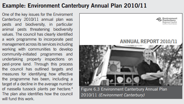
-
Parliamentary Commissioner for the Environment, 2009, Change in the high country: Environmental stewardship and tenure review, Parliamentary Commissioner for the Environment, Wellington
-
Parliamentary Commissioner for the Environment, 2008, Ecological processes in the South Island pastoral high country, Report No. 1955, Parliamentary Commissioner for the Environment, Wellington
-
Minister of Conservation v Western Bay of Plenty District Council EnvC Auckland A071/2001, 3 August 2001.
-
Forest & Bird Protection Society Inc v Central Otago District Council EnvC Auckland A128/04, 23 September 2004
-
Minister of Conservation v Western Bay of Plenty District Council EnvC Auckland A071/2001, 3 August 2001, paras 36, 49
-
For the purposes of this section, a river means a river whose bed has an average width of 3 metres or more where the river flows through or adjoins an allotment; and a lake means a lake whose bed has an area of 8 hectares or more (s 230(4))
-
Meridan Offers Mitigation Plan. Otago Daily Times, 2009. http://www.odt.co.nz/the-regions/north-otago/62772/meridian-offers-mitigation-plan
-
Final Report and Decision of the Board of Inquiry into the Transmission Gully Proposal, Vol. 1. Board of Inquiry into the Transmission Gully Proposal 2012, http://www.epa.govt.nz/Publications/TGP%20Final%20Decision%20-%20Vol%201%20Report%20and%20Decision%20-%2012%20June%202012.pdf
-
Solid Energy New Zealand and the Business Biodiversity Offsets Program.
-
Final Report and Decision of the Board of Inquiry into the Hauāuru mā Raki Wind Farm and Infrastructure Connection to Grid, Vol. 1. Board of Inquiry into the Hauāuru mā Raki Wind Farm Proposal and Infrastructure Connection to Grid, 2011 http://www.mfe.govt.nz/sites/default/files/media/hmr-final-report-vol-1_0.pdf
-
Parliamentary Commissioner for the Environment Investigating the future of conservation: The case of stewardship land (21 August 2013)
-
Parliamentary Commissioner for the Environment Not 100% - but four steps closer to sustainable tourism (18 February 2021).
-
LINZ Discussion Document: Enduring Stewardship of Crown pastoral land (February 2019) https://www.linz.govt.nz/crown-property/crown-pastoral-land/crown-pastoral-land-management/consultation-enduring-stewardship-crown-pastoral-land#block-block-64
-
Section 62(1)(i) Resource Management Act 1991.
-
Man O’War Station Ltd v Auckland Council [2017] NZCA 24.
-
See for example: Environment Southland Regional Policy Statement (2017).
-
Oceana Gold v Otago Regional Council [2020] NZHC 436.
Last updated at 2:09PM on August 26, 2021